

Students from isolated zones
Student identification
Identifying the number of students from isolated areas of Queensland attending each non state school assists the government in allocating the needs component of recurrent assistance. Student isolation is based on the student’s home address when they are not attending school.
Home address means the residential address where the student would usually live with a parent/ guardian when they are not attending school.
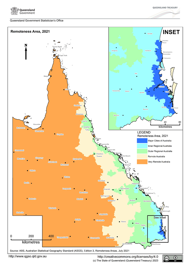
You can view a map of student isolation further down this next page.
You should include only students whose home address is designated Remote Australia or Very Remote Australia in this section of the Census form.
Note: Areas in and around Cloncurry and Mount Isa may be designated as either Remote Australia or Very Remote Australia. Schools with students from these areas should use the Australian Bureau of Statistics (ABS) mapping tool to determine the designation of the home addresses of these students. The tool is available at https://dbr.abs.gov.au/absmaps/index.html. Choose 2021 Remoteness Area (RA) as the Boundary Type, type the address into the address box, and click the Search icon. Then, click the ![]() box, which will bring up the region.
box, which will bring up the region.
Examples of the address searches:
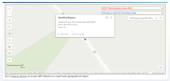
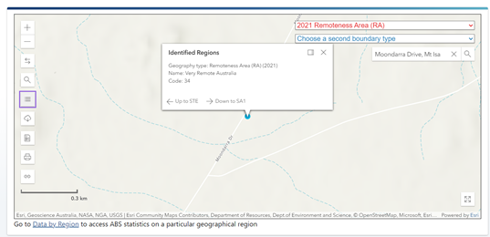
Schools should retain the results of these searches for audit purposes.
Map of student isolation
Interstate students
For students from another State or Territory, use the ABS mapping tool to determine isolation.
Note: This is not applicable for students in distance education.
If you have any questions about a student’s eligibility, please contact the NSSAB Secretariat.
Students to exclude
- students whose home address is located in Outer Regional Australia, Inner Regional Australia or Major Cities of Australia
- overseas students (refer to Overseas students in these instructions), and
- students on visitor visas, bridging visas with study limitations or no visa (refer to Students on visitor visas, bridging visas with study limitations or no visa in these instructions).
>> Completing the Isolated students fields
Last updated 30 January, 2026